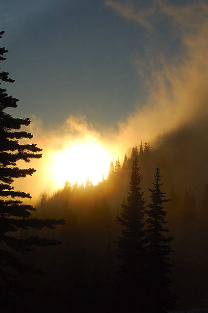
Naches Peak Loop beckoned for one main reason: a vantage point halfway around the 4.5 mile loop that had 360 degree views. We planned our visit around the full moon, and hiked later in the day to position ourselves for a sunset over Rainier and then a full moon rising in the other direction over Dewey Lake. Mist ballooned up from the cooling valleys, filtering sunlight as it rose. Our group stash of wine, port, and chocolate provided “popcorn” for the show. With headlamps on, we walked back out to our cars along dirt trails and forest snowfields.
Naches Peak was located on the middle eastern edge of Mount Rainier National Park, where 410 curved out to the east. The best way around the loop was to park at Tipsoo Lake, hike up to the Pacific Crest Trail ridge, and walk the loop around from there to its outlet back closer to the cars. Or, you could do a somewhat shorter out-and-back to the viewpoint by walking in from the lower part of the loop, which was just up the road from the Tipsoo Lake parking area. The trail was not tree-marked above the dirt trail hidden under the early summer snowfields, so hope that there are some knowledgeable bootprints ahead of you to lead the way!
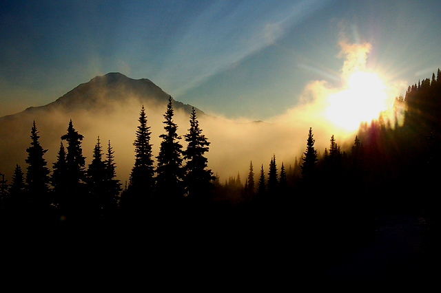
Sun setting over Mt Rainier, from Naches Peak Loop trail
View from Naches Peak Loop

The mist rose from the cooling valleys below…
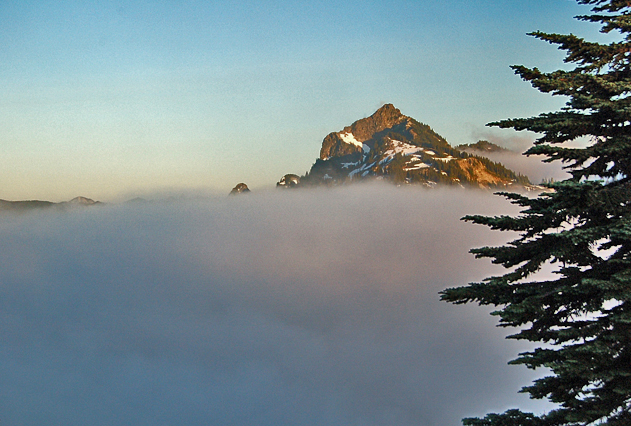
… and filled the valleys around us. View of Seymour Peak where the full moon later rose.