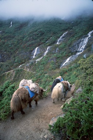
Yaks descending the same valley trail along which people and yaks have traveled between villages for many centuries. Yaks are popular domesticated animals because of their strength, utility, and generally docile behavior (except for the occasional goring). Since there is no wood to burn at higher elevations, people gather yak shit plops and flatten them with their hands into yak shit pancakes that are dried in the sun and then burned for heat or in the kitchen stove.
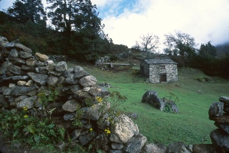
This is a typical Solu Khumbu stone house; this one basically makes up the entire “village” of Lhafarma. Rocks are fitted together loosely to form walls and pasture fences, and the roof is covered with flat rocks resting on timbers brought up from lower elevations. Animals live on the bottom floor in cold weather, and the family lives on the second floor. Many of these houses are seasonally occupied; this one seemed vacant.
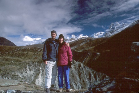
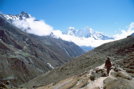
Scott and Karen on a bluff near the village of Machermo, as we’re heading north up valley toward the mountains in the distance. This was one of the first mornings where the rainless monsoon clouds started opening up in the early part of the day to reveal the spectacular views. Eventually, the clouds were gone almost all day long as we approached Everest and for the rest of the trek after this point.
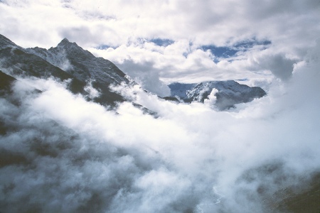
Morning view of monsoon clouds rolling up the valley like a tidal wave. The view would be clear in the earliest morning hours, and then suddenly the day’s heat would create a wall of huge clouds that quickly rolled up and over ridges to engulf the mountains. It was neat to see the region in all 3 stages as we progressed through the trip: 1) socked in monsoon clouds all day, 2) open views and then clouds building around the mountains, and finally 3) open views all day.
Karen walking down valley past the kharka (grazing grounds) of Phangka. You can see the multiple parallel paths that have been formed over the centuries by people and animals trying to avoid each other going in opposite directions. Also, you can see a trail on the opposite side of the valley that links to other remote villages consisting of just a few houses (the slightly lighter green areas over there are small pastures around people’s homes).
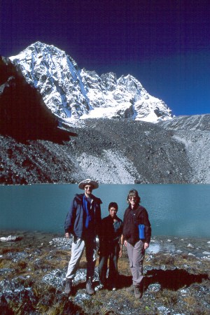
Scott, Kamal, and Karen by Taujung (Second Lake) as we approach the upper reaches of a valley near the most remote village of Gokyo. These lakes formed half the headwaters of the Dudh Kosi (Milk River, named for the whitish gray glacial flour sediment in it) that we had been following for a week.
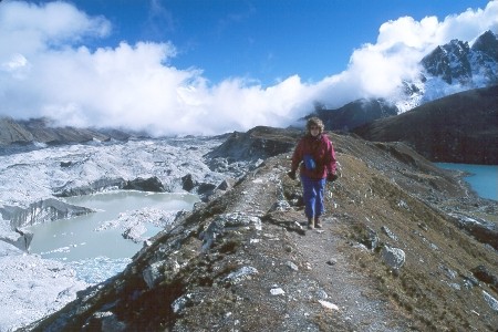
Karen walking along the lateral moraine left behind by the Ngozumpa Glacier (which is the gray “landscape” on the left) when the glacier was much larger during earlier, colder millennia. The Ngozumpa is Nepal’s longest glacier (25 miles). Due to climatic changes on Earth, it is actually receding and not restoring itself as it melts, except at it’s very head. We met a Scottish team of glaciologists who were there to study the glacier and its relative health. In the lake formed on the left, we could constantly hear the sound of rocks and ice falling into the water, another sign of its melting. The Gokyo kharka is just visible on the lake shore to the right, and the trail between the remotest villages ends there. We went up valley further beyond the trail to explore more lakes and to get closer views of mountains such as Cho Oyu and Nameless Fangs.

There’s Mt. Everest, the highest mountain in the center, with Lhotse and Nuptse to its right. This view is from the the summit of Gokyo Ri, where we ascended from the village of Gokyo. Altitude sickness hit me here, but I kept pushing until I got to the top, and it was very worth it. The Ngozumpa Glacier and its lateral moraine are in the bottom half of the picture. The 360 degree view was extremely beautiful in its starkness and scale, and it clearly made the point that while Everest is impressive, it is just one of many really huge Himalayan mountains that are up there in all directions.
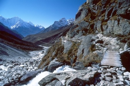
The path back down valley from the upper reaches of our trek, again following the Dudh Kosi and diverging off for some different side trips on the way. It was of course considerably faster going down than coming up. This was not only because of the obvious difference in effort, but also because of the scheduled stops trekkers need to take on the way up to avoid altitude sickness (limit to 1000 feet elevation gain per day once past the 9000-10000 foot level, with a rest day every 3000 feet). It was an enjoyable hike back to Lukla, and a really great trip all around!